A strong cold front will be moving across Kansas on Thursday and it is expected to trigger showers and thunderstorms.
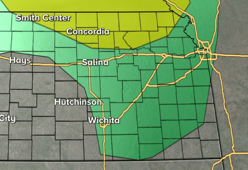
Some of the storms could be severe in northern and northeastern Kansas, mainly along and east of I-135, according to KFDI’s weather partners at Storm Team 12. The severe storms could have up to golf-ball-sized hail with wind gusts up to 65 miles an hour. There will be a slight risk of severe weather in central and south central Kansas, including the Wichita area.
The highs on Thursday will be in the 80s, with south winds gusting up to 40 miles an hour. Parts of northwest Kansas will be under a high wind warning for Thursday evening through Friday afternoon with gusts up to 55 miles an hour. The winds could blow down trees and power lines and make travel difficult across the area. A Red Flag Warning was also in effect for west central areas of the state for a high fire danger with dry conditions and gusty winds.
A Wind Advisory was in effect for south central and parts of southeast Kansas until 7 p.m. Thursday for wind gusts up to 45 mph.
The cold front will drop temperatures into the 50s and 60s for Friday into the weekend.
[ map: KWCH ]


