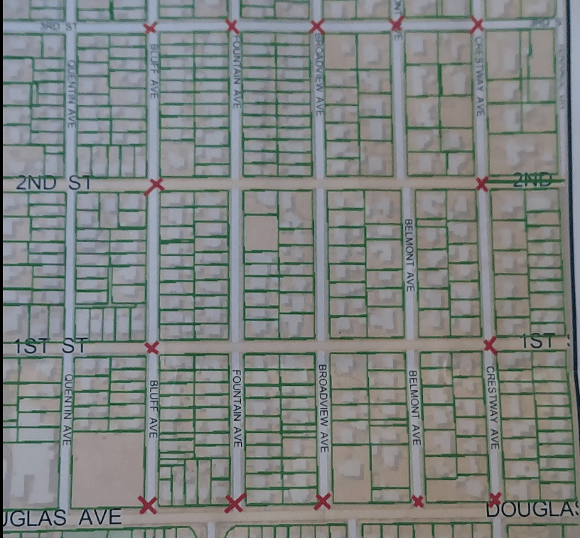
The College Hill Neighborhood Association has released a map showing the street closings that will be in place for Halloween night, when hundreds of people turn out for trick-or-treating and to see the elaborate displays created by residents.
Streets will be blocked off from 5 p.m to 9 p.m. on Halloween night, and there will be 14 barricades placed to close off the streets between 3rd Street and Douglas, from Bluff to Crestway.
The Neighborhood Association will also hire 11 off-duty police officers and sheriff’s deputies to patrol in the area, and they will be encouraging trick-or-treaters to head home by 9 p.m.
The safety measures are a response to an incident last year in which a 4-year-old boy was struck by a car and injured. Drivers are being urged to slow down and pay extra attention on the residential streets across Wichita.
[ image: College Hill Neighborhood Association – Facebook ]


